Stay updated and subscribe to the KRSC Newsletter
Project 01

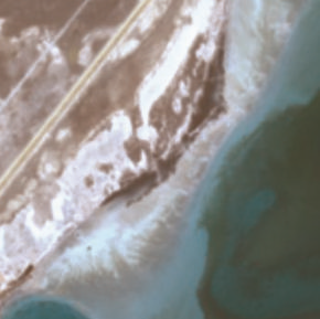
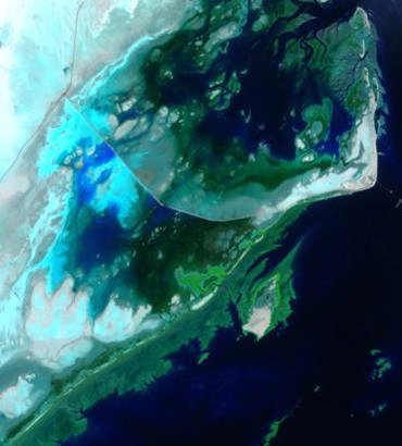
Sir Bani Yas Island, United Arab Emirates

Multi-temporal mangrove expansion monitoring, August 2024 to August 2025

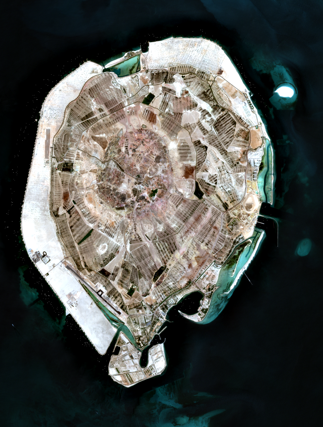
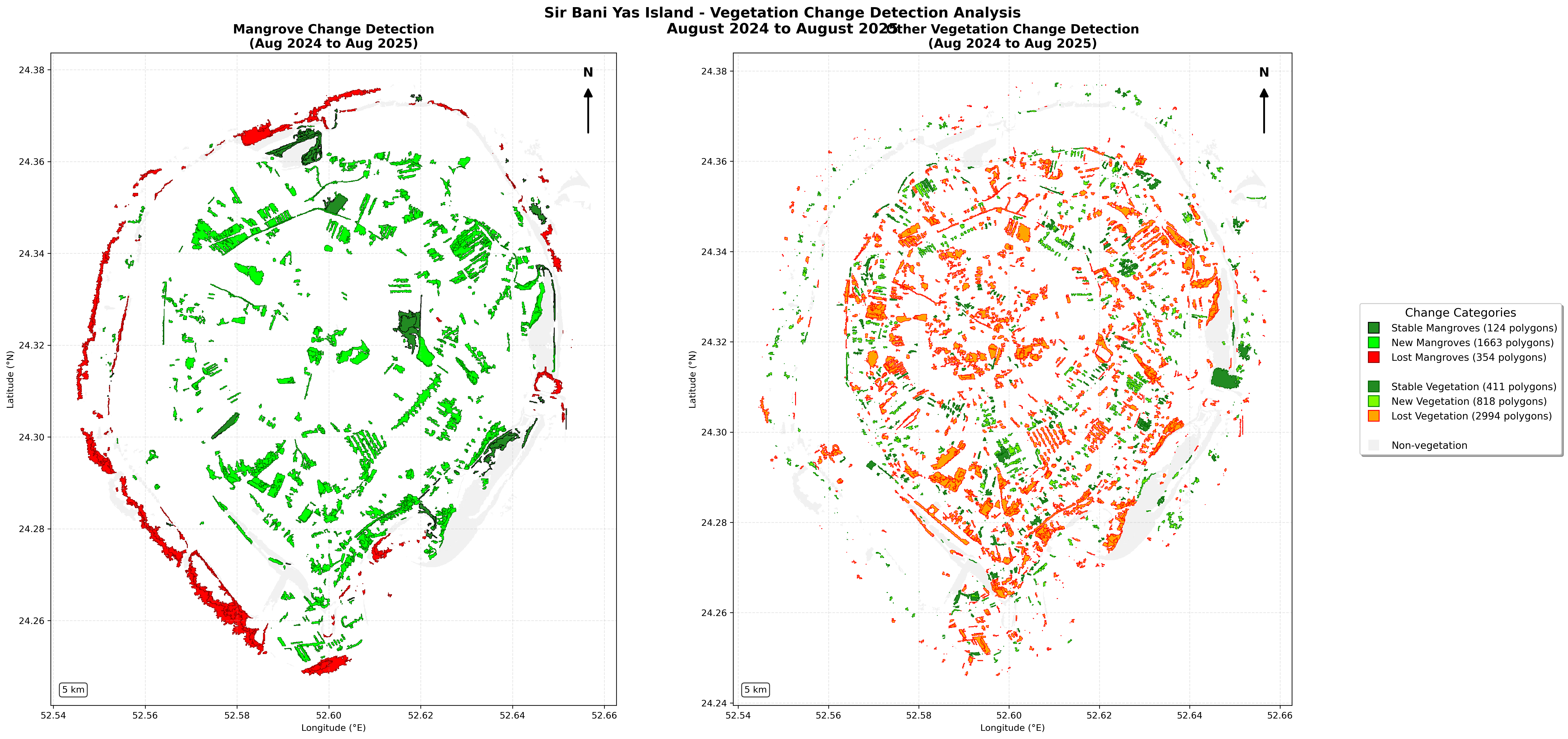
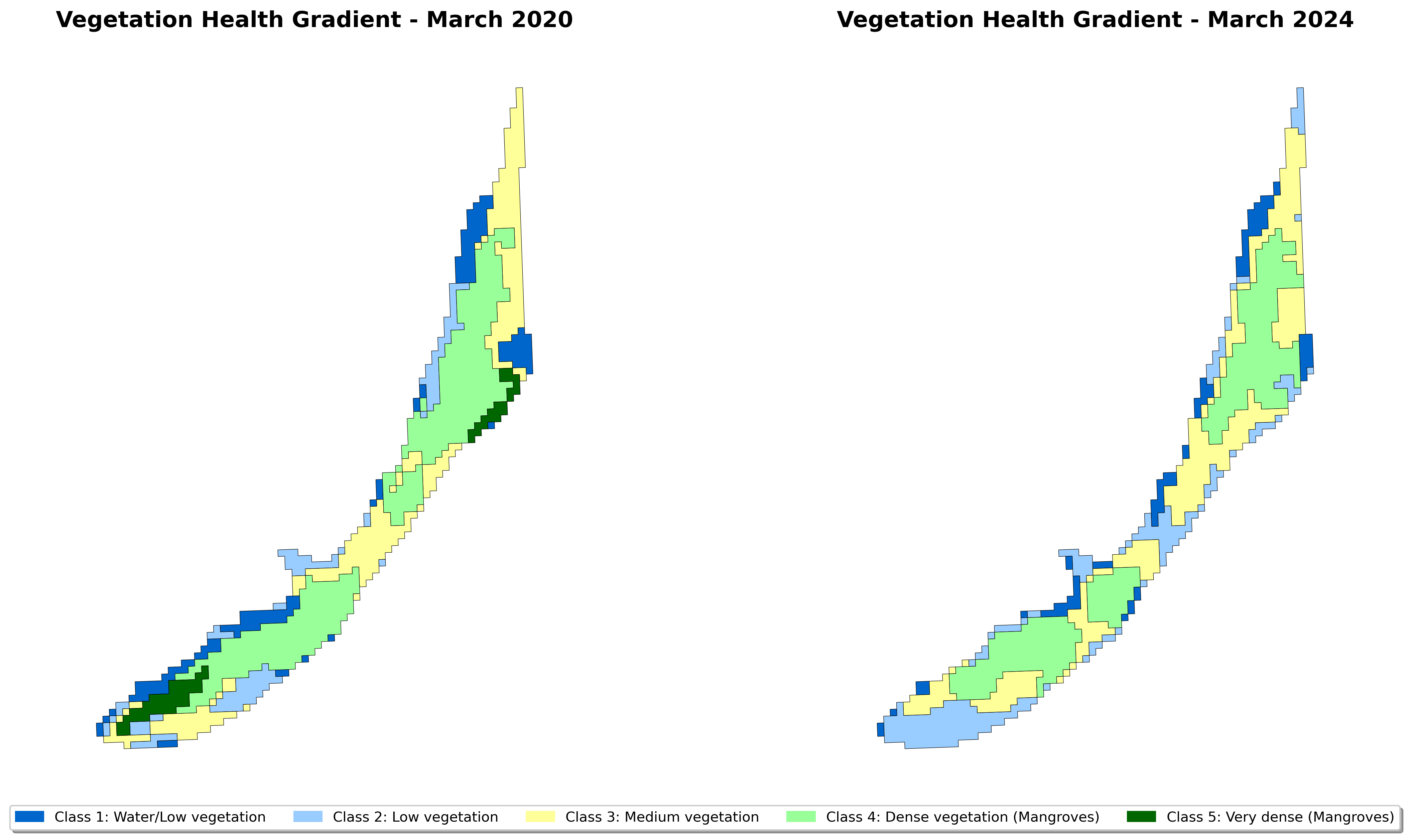
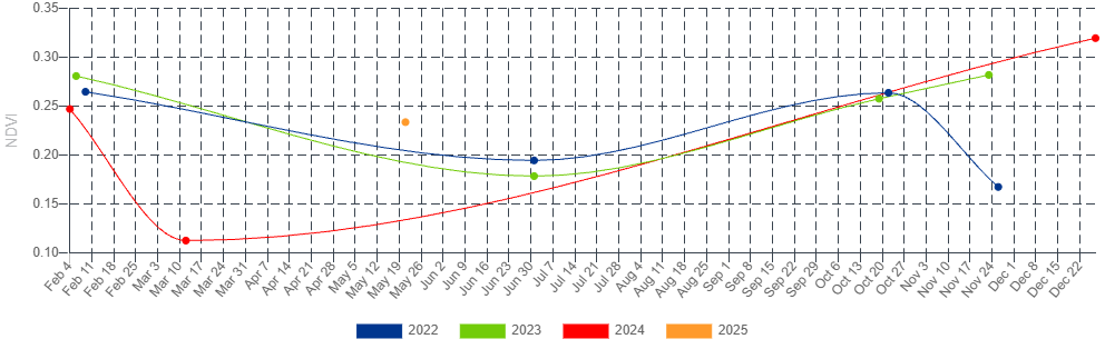
KRSC has conducted a series of advanced satellite-based studies across three mangrove and coastal vegetation sites in the Arabian Gulf region, applying machine learning and multi-spectral remote sensing to independently assess ecosystem change, vegetation health, and carbon sequestration outcomes. At Sir Bani Yas Island in the United Arab Emirates, multi-temporal analysis using NDVI, SAVI, NDWI, and EVI indices across four acquisition dates between August 2024 and August 2025 revealed a striking ecological transition: mangrove coverage expanded by 91.2 percent, rising from 535.6 to 1,024.1 hectares. AI-assisted spatial clustering identified 59 distinct mangrove aggregations and 81 isolated patches across the island.

Coverage growth
+91.2%
Area
535.6 to 1,024.1 ha
Aggregations identified
59
Isolated patches
81
Time window
Aug 2024 to Aug 2025
Indices used
NDVI, SAVI, NDWI, EVI
Project 02

Abu Ali Island, Kingdom of Saudi Arabia

Restoration program assessment, March 2020 to March 2024

At Abu Ali Island on Saudi Arabia's Arabian Gulf coast, a comparative analysis of Sentinel-2 imagery from March 2020 and March 2024 tracked the progress of Saudi Aramco's long-term mangrove restoration program under the Saudi Green Initiative. Vegetation health mapping across five NDVI density classes revealed a net decline of 25.5 percent in mangrove coverage, from 3.76 to 2.80 hectares. The NDVI time series flagged pronounced mid-year stress consistent with peak summer heat and saline conditions in this historically oil-impacted intertidal zone.

Coverage change
-25.5%
Area
3.76 to 2.80 ha
Imagery source
Sentinel-2
NDVI density classes
5
Time window
Mar 2020 to Mar 2024
Stress signal
Peak-summer heat, salinity
Project 03

Mangrove Restoration Site, Sultanate of Oman

AI-assisted blue-carbon verification, 2015 to 2025

At a 280-hectare mangrove restoration site in Oman, KRSC deployed an Isolation Forest anomaly detection model alongside a suite of arid-environment spectral indices, including a custom Arid Mangrove Health Index and a Salinity Stress Detection Index, to independently verify carbon sequestration claims over a ten-year window from 2015 to 2025. The analysis confirmed 8,391 tCO2 per year at a 91 percent confidence level, against a project-claimed figure of 130,723 tCO2 per year, highlighting the critical role of AI-powered independent verification in blue carbon markets.

Site size
280 hectares
Verified sequestration
8,391 tCO2 / year
Confidence level
91%
Project-claimed figure
130,723 tCO2 / year
Time window
2015 to 2025
Methods
Isolation Forest, AMHI, SSDI

Across these three sites, KRSC has demonstrated that rigorous, AI-assisted remote sensing can independently confirm, contest, or contextualize the environmental claims attached to coastal restoration programs in the Gulf. Independent verification matters most where regulatory and market incentives reward optimistic reporting.

Discuss a project with us